Updated method for database access
The dataset can be accessed via Opendap. For bulk downloads, register for an API and follow the instructions here. Wishing you the best in your research!
The dataset can be accessed via Opendap. For bulk downloads, register for an API and follow the instructions here. Wishing you the best in your research!
Starting with WRF v4.6, support for distributed urban parameters has been integrated into the Single-Layer Urban Canopy Model (SLUCM). This update allows modelers to incorporate spatially heterogeneous urban canopy characteristics into numerical weather simulations. Key Features & Parameters The distributed urban parameters available in this release include: Aerodynamic Roughness Parameters: Roughness length for momentum and […]
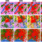
Annual Past-Present Land Cover Classification from Landsat using Deep Learning for Urban Agglomerations Worameth Chinchuthakun, David Winderl, Alvin C.G. Varquez, Yukihiko Yamashita, Manabu Kanda Overview UrbanLC is a Python library for land cover classification (LCC) from Landsat Images. It features pretrained deep learning models, which are compatible with all Landsat sensors up-to-date: MSS, TM, and […]
A github repository for the tools introduced in this site and the tools used to construct the datasets can be found below: https://github.com/TokyoTechGUC The above repository is continually being improved and advanced by the members of the lab.
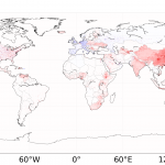
Global 1-km present and future hourly anthropogenic heat flux Alvin C.G. Varquez, Shota Kiyomoto, Do Ngoc Khanh, and Manabu Kanda AH4GUC is an updated version of AHE dataset by Dong et al. An article of the dataset can be accessed here. In addition, a futuristic scenario based on SSP3-RCP8.5 is also constructed. Specifically, the highlights of […]
Updated March 17, 2023: Additional paper reference and manual In collaboration with the Hanaoka Research Group led by Prof. Shinya Hanaoka, an update of the SLEUTH model is proposed to consider railway-induced urban growth in a widely known cellular-automaton-based urban growing model called SLEUTH. The papers related to the work can be found below: Varquez, […]
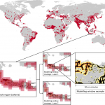
High-resolution Global Urban Sprawl Projection based on multiple applications of SLEUTH urban growth model (2019) Yuerong Zhou, Alvin C.G. Varquez, Manabu Kanda Full publication here. An annual dataset of global urban sprawl projection with 30 arc-seconds, around 1-km resolution, has been constructed. Urban sprawling was projected using the SLEUTH urban growth model which utilizes historical […]
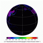
Global anthropogenic heat flux database with high spatial resolution Y. Dong, A.C.G. Varquez, M. Kanda Atmospheric Environment (2017) http://dx.doi.org/10.1016/j.atmosenv.2016.11.040 A monthly-representative hourly dataset (currently in local time) of anthropogenic heat fluxes has recently been launched. We have stored geo-referenced tiffs with global coverage in a database free for anyone to download and use. […]